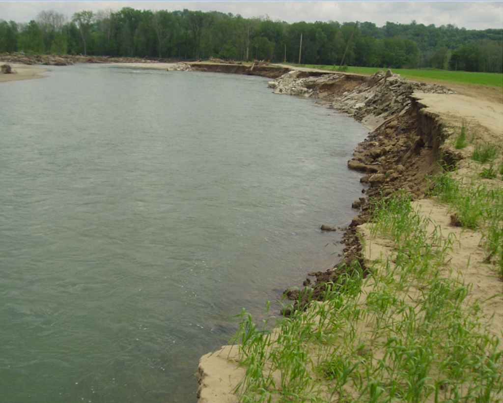
Levee Road, Whitewater River near Brookville, Indiana
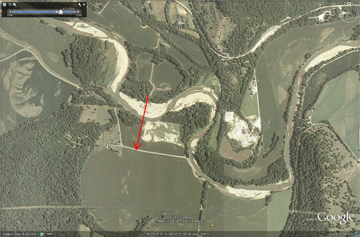
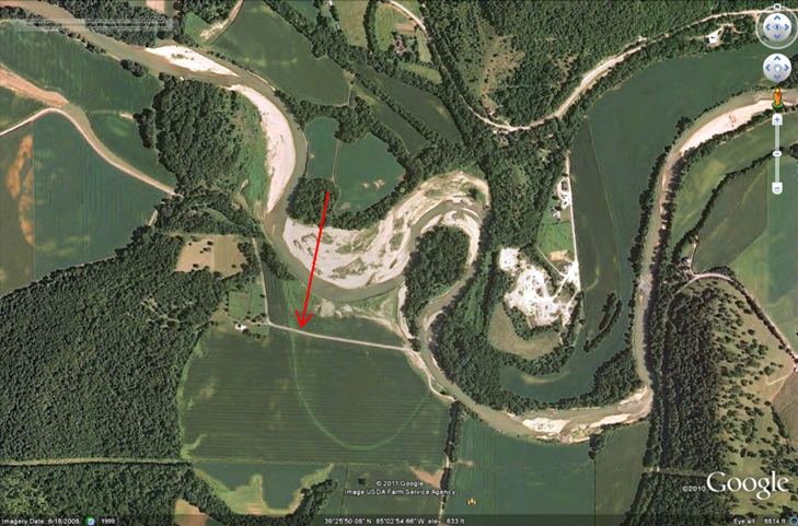
Before and after photographs can quickly illustrate the concerns that individuals and communities must be aware of when they place structures near stream channels. The three images below illustrate the changes in a portion of the Whitewater River near Brookville, Indiana. The first two images show that between 2006 and 2008, the river moves between 330 and 365 feet closer to Levee Road (highlighted at the end of each arrow). The third image, take on a field trip to Levee Road in May 2011, documents that the channel continued to migrate in the direction of the cutbank and undermined Levee Road, leaving it impassable. The road was relocated by August 2012.
It is important to note that these images represent extreme examples of river erosion in Indiana. We use them because they make the erosion process easier to see. Many Indiana rivers are essentially stable, or change very slowly.
White River near Centerton, Indiana
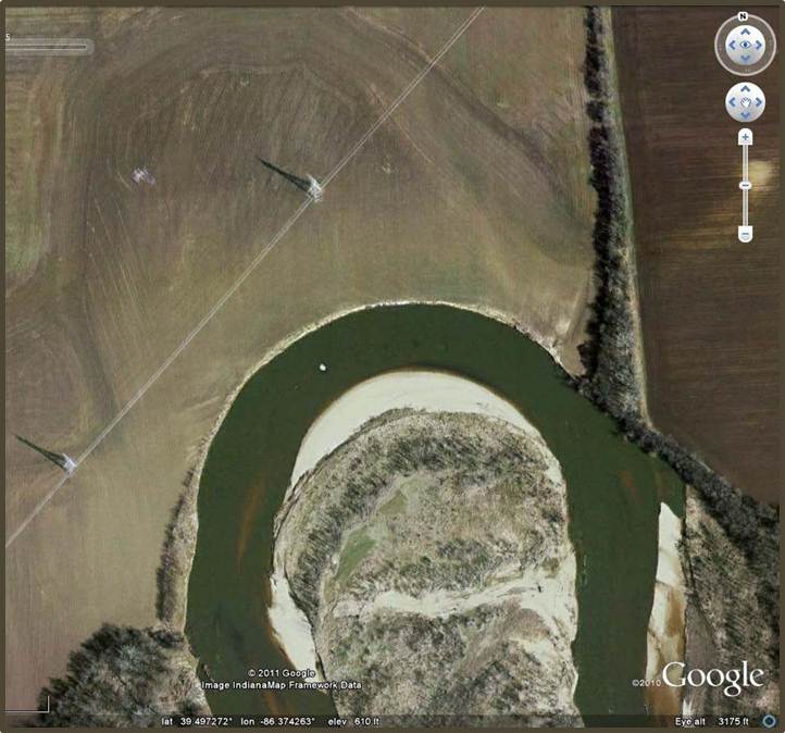
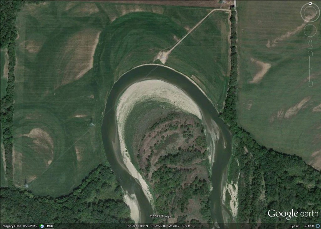
In another example, the two images below document that this cutbank, located on the White River near Centerton, Indiana, had migrated 290 feet to the northwest within a 5-year period. In addition to the agricultural land that was lost to the river, notice the existing utility poles threatened by future fluvial erosion.

